

Initially, I used a "3D photogrammetry" technique to scan the area from a drone and use software to piece together a 3d model.
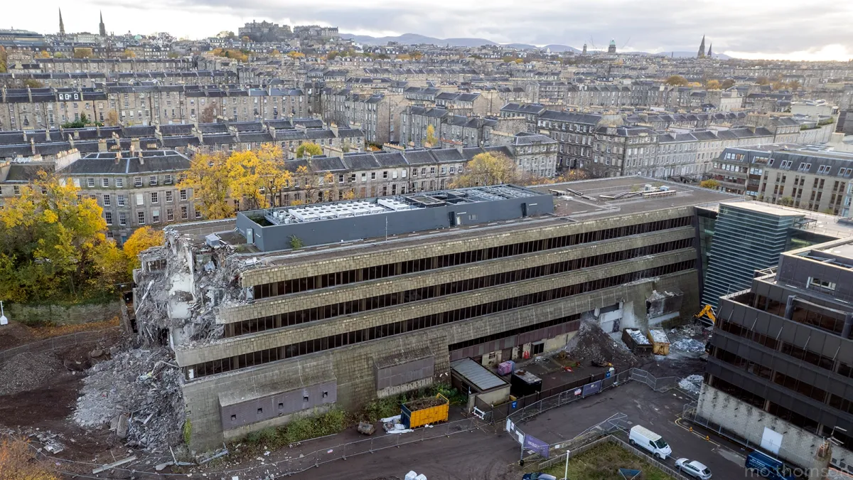
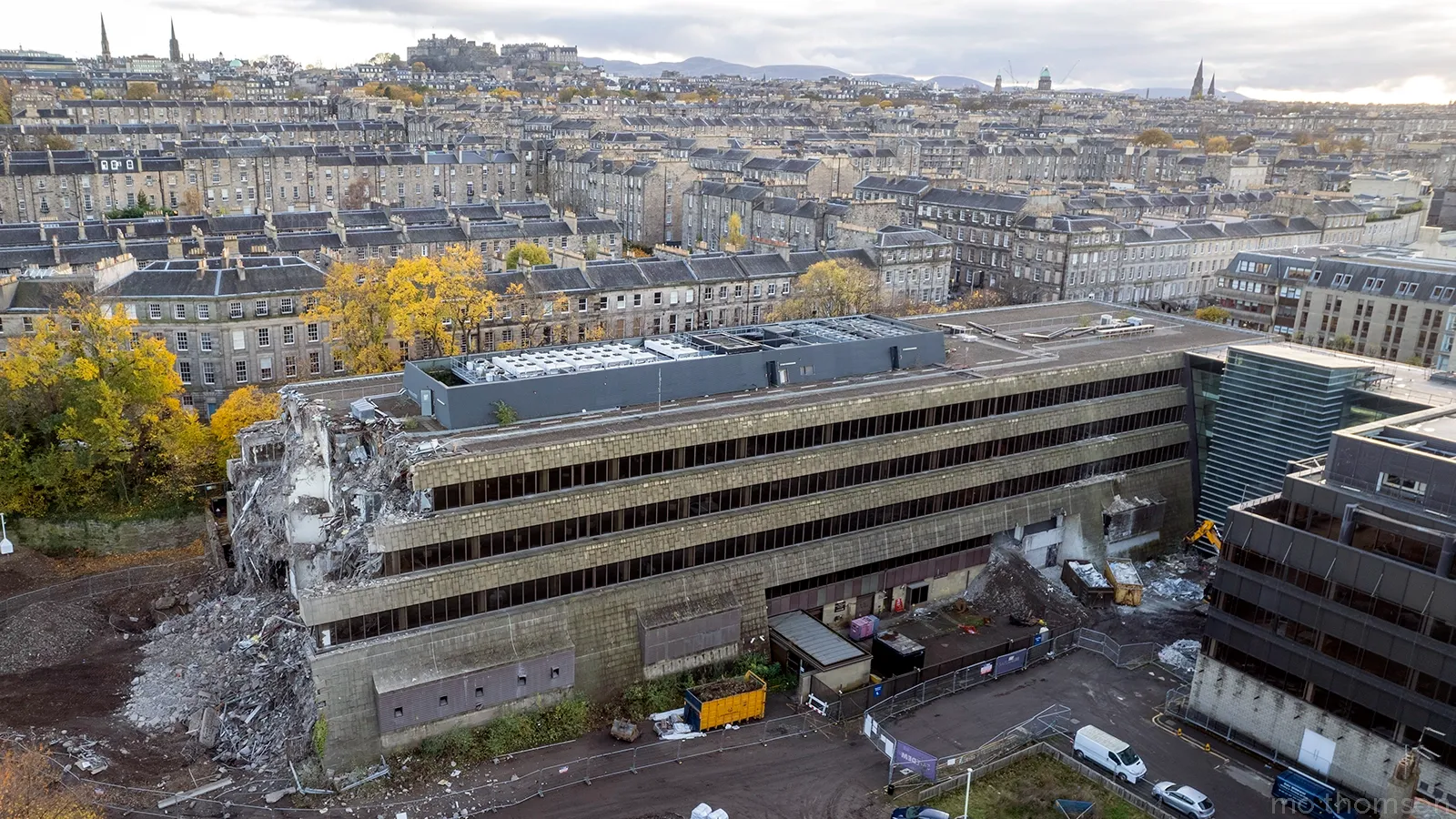
Problem number one with the method was that the buildings started to be demolished in November 2021. I couldn't fly my big drone from the streets around Fettes Row or Dundas Street to get some detailed shots.
I did get some aerial shots of the back of the buildings in late November taken from above the park with my bigger drone, using a rule that permits recreational flying from parks.
I eventually got some detailed aerial shots from the streets of a mostly demolished Fettes Row in May 2022 using my little Mavic Mini drone.
It weighs less than 0.25kg and I can fly it legally in the city centre as long as I don't fly above "crowds of people".
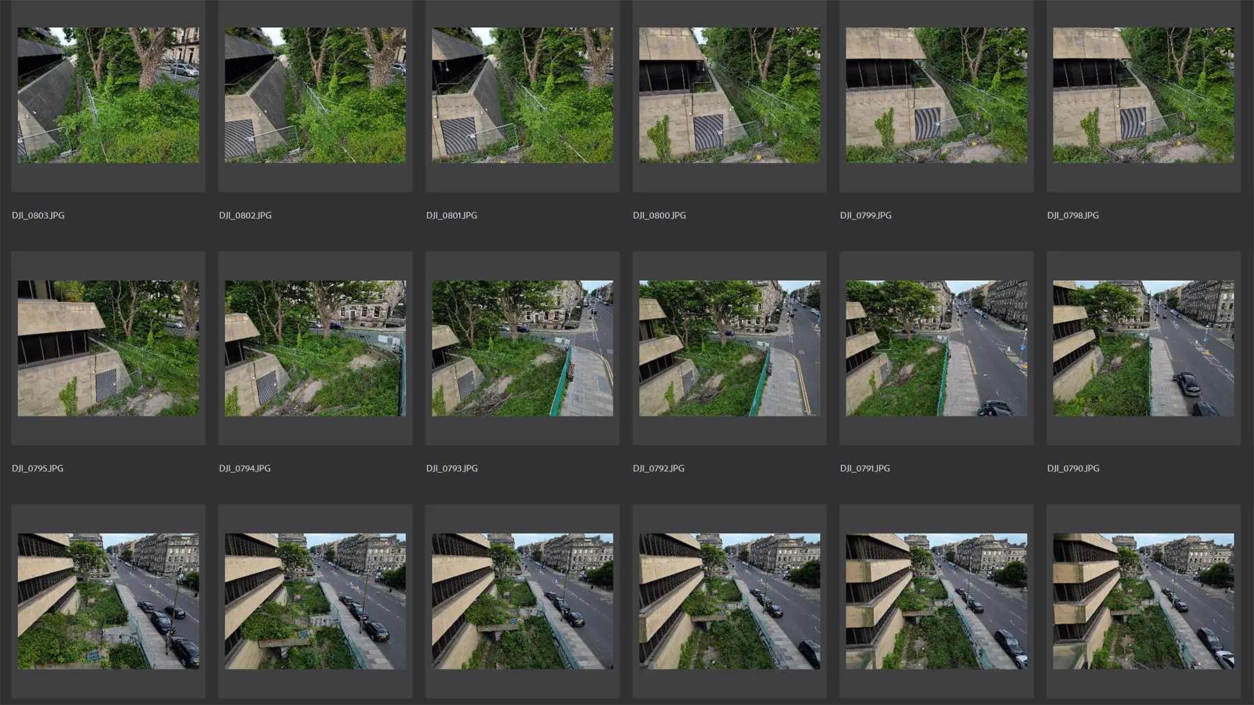
I took around 900 images of Fettes Row and Dundas Street from the street level and fed these into photogrammetry software. The software analyses images taken from different positions to generate a "3D point cloud"

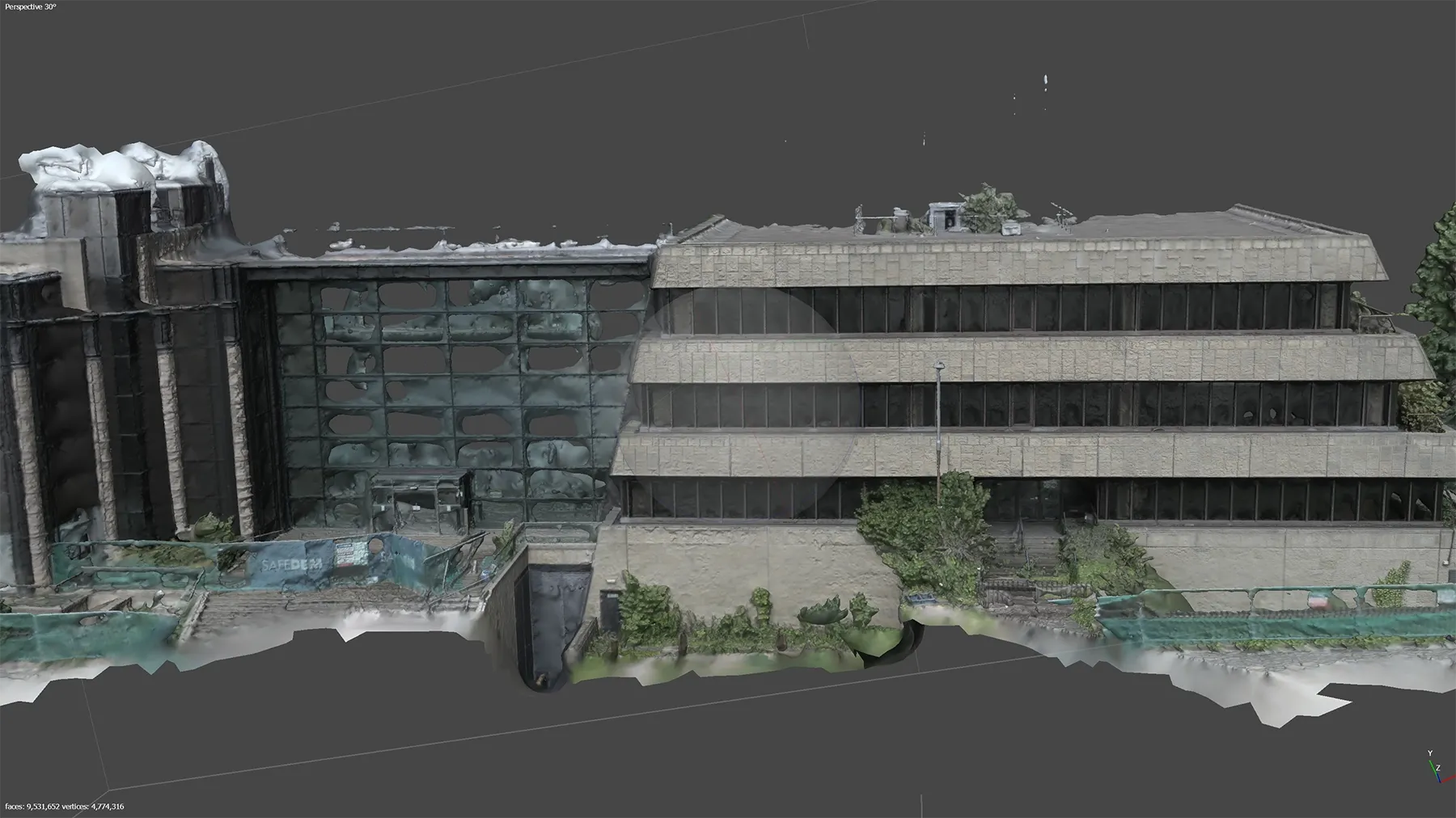
Once the 3d points are calculated, the software can apply textures, which can all be saved in a 3d file format.
The 3d model looked quite nice, but it was a bit lumpy with lots of artifacts. Photogrammetry techniques can't handle glass reflections very well.
The 3d model was just under 100 million polygons, which is too big for anything practical.
The photogrammetry based model wasn't going to work for internal shots, it would only cover the exterior.
It was useful as a learning exercise, but I decided to drop the photogrammetry method. I learned how to create a 3d model from scratch, which is covered in the next blog post and opened up new possibilities by getting a 3d model of Edinburgh into the mix.